
STADO is StratoFirma’s physical AI for unmanned systems. An operator gives a mission in plain language; STADO turns it into a coordinated plan, proposes it on the map, and flies it across multiple aircraft — each running STADO Core on-board — holding the mission together when GPS and the comms link fall away.
For defense and public-safety operators running more than one unmanned system at a time.
- ·Natural-language command into coordinated multi-drone missions
- ·GPS-denied navigation that runs on edge compute, on the aircraft
- ·On-board decision-making that holds when the comms link drops
- ·Scales from a single drone to a coordinated swarm
Command in plain language
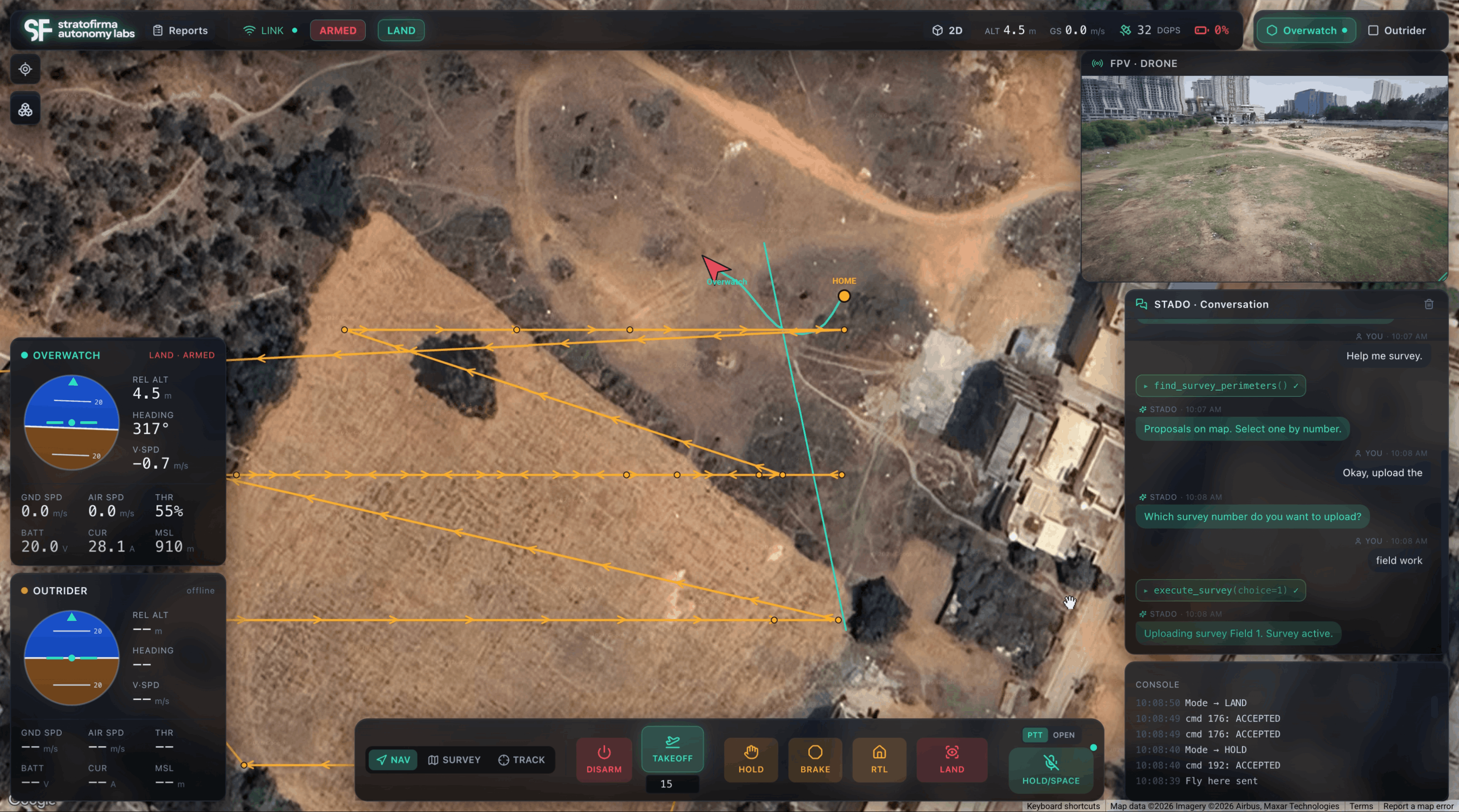
Type the intent — “survey this field,” “track that target” — and STADO calls the right routines, lays proposals on the map, and waits for you to pick one. No waypoint-by-waypoint babysitting. The console keeps a running transcript of every command and the system’s response, so the mission stays auditable as it runs.
One operator, a whole flight
Run more than one aircraft from a single console. STADO tracks each platform’s position, heading, speed, altitude, and battery in real time, and exposes arm, takeoff, hold, return-to-launch, and land as first-class actions. Overwatch and Outrider fly the same mission together.
Autonomy that holds at the edge
Navigation and decision-making run on compute carried on the aircraft, not in the cloud. When GPS degrades or the link drops, the mission keeps going — the swarm coordinates locally instead of stalling on a lost signal.
Survey, track, navigate
Built-in mission modes cover the common jobs — area survey, target track, and free navigation — with a live FPV feed and map view side by side, so the operator always has the picture.
STADO Mesh
Mesh radio linkA mesh-capable radio link with up to 10 km of encrypted, high-speed data — the connective tissue for multi-drone missions.
View →Prahari
Indoor securityA sub-500 g GPS-denied indoor security drone that patrols the spaces fixed cameras can’t cover.
View →Overwatch
Hexacopter platformA StratoFirma airframe built for full outdoor operations and longer-range missions.
View →Outrider
Quadcopter platformA StratoFirma airframe built for indoor operations and short outdoor missions.
View →Fathom
Underwater platformA StratoFirma underwater platform — subsea autonomy where GPS and radio never reach.
View →